
Montezuma Parcels A (NF1), B (NF 2), C (NF 3), and D (NF 4)
238.77 Acres located on the North side of the Town of Camp Verde
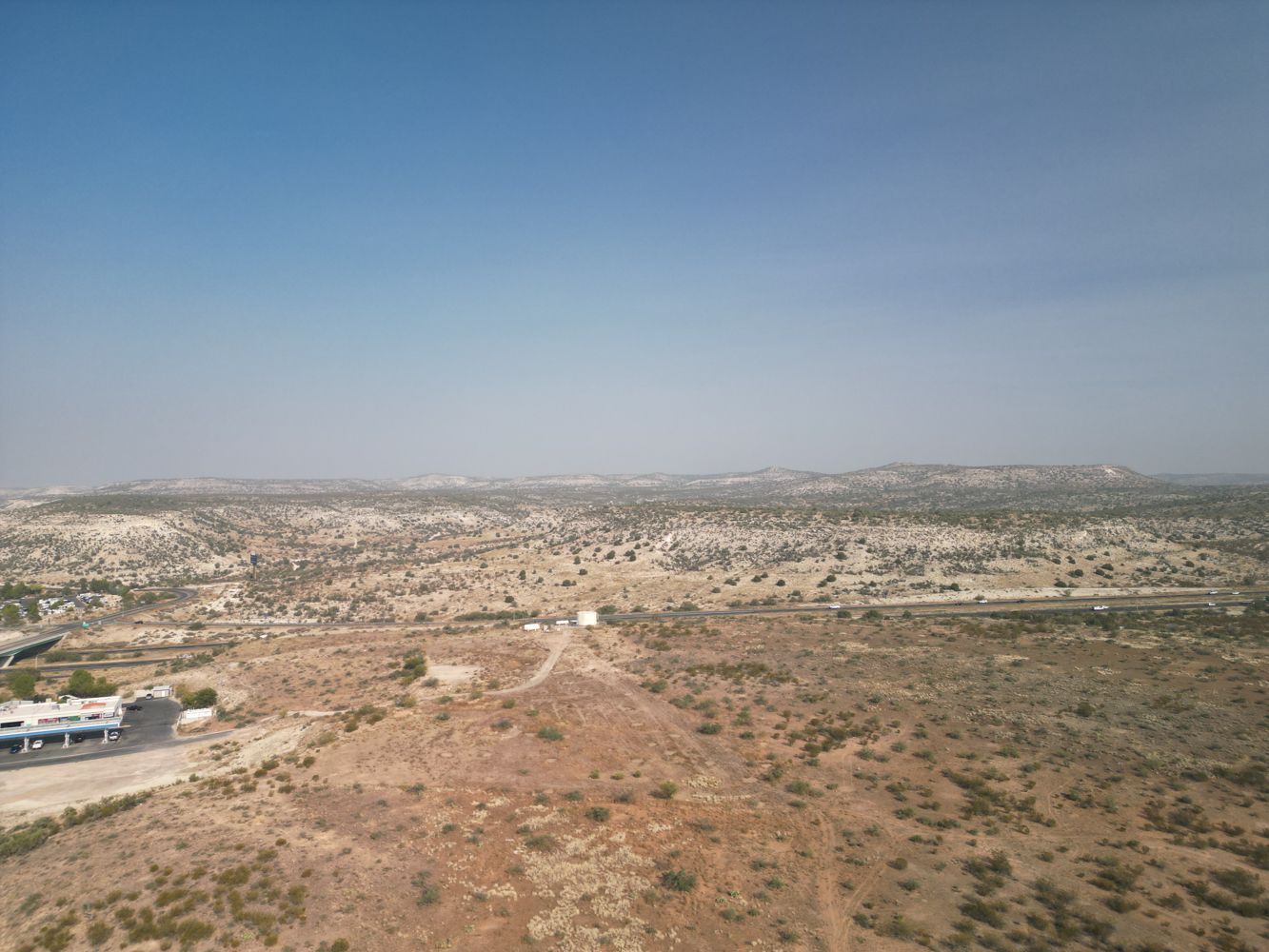
The Montezuma parcels are located on the North side of the Town of Camp Verde (Town) in Yavapai County Arizona, on the south side of Interstate 17 and running along N. Montezuma Castle Highway and Montezuma Castle Road. All of the parcels are within the 1.856 million-acre Coconino National Forest which lies north and east of the Town. The four parcels are grouped together because they are only divided by the Montezuma Castle Highway and Montezuma Castle Road. Following is a summary of the parcels.
Montezuma A Parcel 65.28 Acres, more or less
Montezuma B Parcel 107.29 Acres, more or less
Montezuma C Parcel 46.51 Acres, more or less
Montezuma C Parcel 19.69 Acres, more or less
Total Montezuma Parcels 238.77 Acres, more or less
Camp Verde Town Boundary and General Plan
Although the Montezuma Parcels are entirely National Forest land, the Town of Camp Verde (Town) considers most of it to be part of their community for planning purposes. Not only has the Town included these lands inside their town boundary, they have also included the land in the Town’s General Plan for future development. Only the small portion of Middle Verde A on the east side of Montezuma Castle Highway is not included in the Town boundary and General Plan. The Town has designated this area as the “Pecan Lane Character Area”.
The Pecan Lane Character Area is defined by a row of pecan trees planted in 1927-1928 which is designated on the National Registry of Historic Places as a Rural Historic Landscape. The Pecan Trees are located further to the south along the Montezuma Castle Highway. Also significant to the area are the Nation’s Cliff Castle Casino, a private airport, and the Montezuma Castle National Monument located east of the Montezuma Parcels.
The Pecan Lane Character Area includes zoning for agricultural, residential, light commercial, and heavy commercial, open space, and public facilities for future land use.
Montezuma A, B, C, and D
Montezuma Parcel A is bordered on the north by Interstate 17 (I-17), on the east by Parcel C, and on the south by Montezuma Castle Road. Parcel A borders private Yavapai-Apache Nation Trust land to the west and Montezuma Castle Highway for a short distance. It also crosses south of the Montezuma Castle Road near the southwest corner. On the southwest corner it is bordered on the west by the Yavapai-Apache Cultural Center and on the east and south by National Forest land.
Montezuma Parcel B is on the west side of Montezuma Castle Highway southwest of Parcel A. It’s bordered on the north by Yavapai-Apache Nation Trust land, and on the west and south by private land.
Parcel C has a small portion bordered on the north side by (I-17). On the south it is bordered by the Montezuma Castle Road. It’s an irregular shaped, three-sided parcel which borders Montezuma D Parcel to the northeast.
Montezuma D is bordered on the north by I-17 and on the east by Montezuma Castle Road. It is bordered on the south by Montezuma Parcel C.
Water Rights/Claims
Per the Arizona Department of Water Resources, there are no Statements of Claimant associated with the Parcels. Likewise, there are no surface water documents associated with the Parcels.
Utilities
There are several permitted overhead electricity transmission lines crossing the Parcel but are not sized for development. There is no water or sewer available on the Parcel for development.
Access
Interstate Highway I-17 borders the northern side of Parcels A, C, and D but does not provide either physical or legal access to the parcels.
Montezuma Castle Highway borders Parcel A on the west, and B on its eastern side but does not provide legal access. There is no developed access, however there are some dirt roads/tracks leading onto the property from Montezuma Castle Highway.
Montezuma Castle Road borders the southern side of Parcels A, C, and D but does not provide legal access. There is no developed road access, however there are some dirt roads/tracks of the Montezuma Road onto the properties.
Intergovernmental Agreement
In June 2022, the Town of Camp Verde (Town) and the Yavapai-Apache Nation entered into an Intergovernmental Agreement (IGA) to address, among other things, certain “land use, development, and in lieu of taxes issues” associated with the Nation’s acquisition of the Federal Parcels and their corresponding addition to the Yavapai-Apache Nation. The IGA describes how the acquired lands will be managed by the Nation upon completion of the exchange. The IGA also includes provisions addressing a tax-sharing arrangement between the Nation and the Town. This required a public process led by the town of Camp Verde for its community members and by the Nation for its community members. This formal agreement recognizes the significant benefits of the proposed exchange to both the Town and the Nation. Their lands being closely intertwined, the parties have established a cooperative and mutually respectful and beneficial relationship. Both the Town and the Nation wish to provide for the health and prosperity of their communities.
The Town recognizes that the Nation’s lands once spanned much of what is now the State of Arizona but now total less than three square miles, about 1,800 acres. The Nation has a young and growing population that requires more land. The Nation and Town negotiated an agreement to clarify the future relationship of the Parties regarding land use, development, and in lieu of taxes assuming the land exchange comes to fruition.
The IGA notes the Town’s interest in generating sales tax revenue through in lieu taxes. As mentioned, the Town has already identified the potential future lands in their 2016 General Plan and desires that any future development be consistent with their zoning standards.
The IGA provides a mechanism under which the Nation and the Town will consult with each other on issues such as Traffic Analysis, Zoning, Building Standards, Fire District Inspections, Law Enforcement and Emergency Services. The IGA also establishes a Community Planning Group through which the Nation and the Town can work cooperatively to resolve issues of common concern.
The Montezuma Parcels A, B, C, and D are mostly within the Town of Camp Verde boundaries and are therefore part of the IGA. The Nation needs this land to meet their needs to provide housing for over 150 people currently on a waiting list to get into their community.
The land exchange is essential to the common goals of both the Town of Camp Verde and the Nation in meeting the growing needs of their respective communities. For more information on the Intergovernmental Agreement click here.
Authorized Uses
Montezuma Parcel A
There is a permitted overhead electrical transmission line crossing the Montezuma A Parcel from the southwest corner toward the middle of the eastern boundary encumbering approximately 0.69 acres. There is also a permitted communication line buried on the north side of, and within the right-of-way for Montezuma Castle Highway.
Montezuma Parcel B
A permitted overhead electricity transmission line crosses the southern boundary of the Montezuma B Parcel near the southeast corner and then heads north to the eastern boundary encumbering approximately 0.18 acres.
Montezuma Parcel C
A permitted overhead electricity transmission line crosses the Montezuma C Parcel from the middle of the western boundary toward the middle of the northern boundary encumbering approximately 0.83 acres.
Montezuma Parcel D
A permitted overhead electricity transmission line crosses the Montezuma D Parcel from the middle of the southern boundary toward the northern corner of the parcel and encumbering approximately 0.71 acres.