
Middle Verde A (NF 7) B (NF 8), and C (NF 9)
725.58 acres on the western side of the Town of Camp Verde
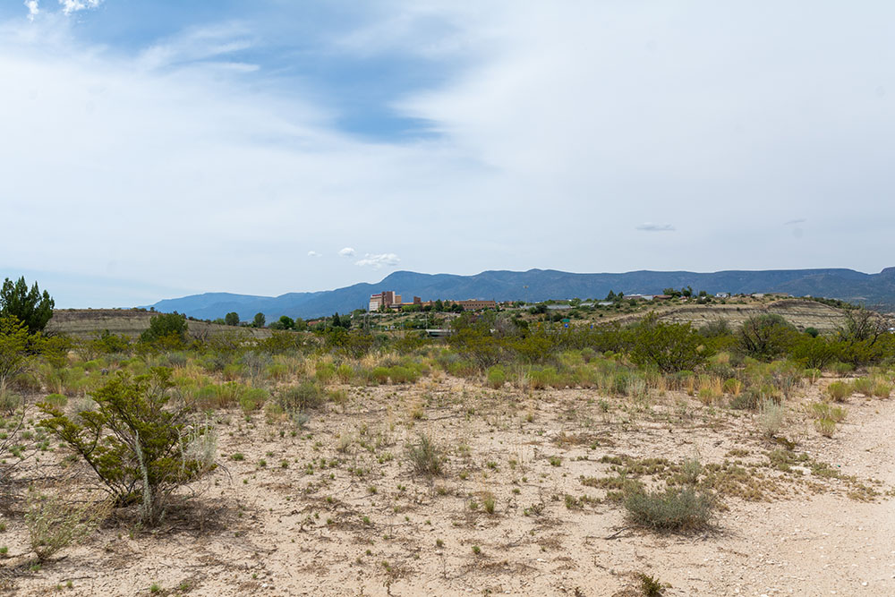
The Middle Verde A, B, and C Parcels (Map) are in Yavapai County Arizona on the western side of the Town of Camp Verde (Town). They are north of the intersection of Interstate 17 (I-17) and Middle Verde Road. All are within the Coconino National Forest and border Arizona State Trust Land and private land. The parcels are contiguous with land owned by Yavapai Apache Nation (Nation) at some borders. They are grouped together because they are only divided by Middle Verde Road. The Parcel sizes are as follows:
Middle Verde A Acreage 543.22
Middle Verde B Acreage 131.97
Middle Verde C Acreage 50.39
Total Middle Verde A, B, and C Total Acreage 725.58
Camp Verde Town Boundary and General Plan
Although the Middle Verde Parcels are comprised entirely National Forest Land, the Town of Camp Verde (Town) considers most of it to be part of their community. Not only has the Town included these lands inside their town boundary, but they have also included the land in the Town’s General Plan for future development. Only the relatively small portion of Middle Verde A on the east side of Middle Verde Road is not included in the Town boundary and General Plan. The Town has designated this area as the “Middle Verde Character Area”.
The Middle Verde Character Area includes zoning for agricultural, residential, light commercial, and heavy commercial for future land use:
Middle Verde, A, B, and C Access
Middle Verde Road runs diagonally through the Parcels northwest to southeast and crosses between being on Middle Verde, A, B, and C. Verde River Drive runs perpendicular to Middle Verde Road. Yavapai County manages and maintains the roads under an easement from the Forest Service.
The Town of Camp Verde has an easement from the Forest Service for right-of-way for Reservation Loop Road and Arena Del Loma Road. The Town manages and maintains these roads.
There are also Forest Service Roads 119J, 119K, an unnamed jeep road, and 9235F on the Parcel.
Significant to the Middle Verde A parcel is the location of Interstate 17 (I-17) which forms the southeast border of the Parcel. There is a full interchange at I-17 and Middle Verde Road (Exit 289) which provides access to residential and commercial property both north and south of I-17. The I-17 highway accounts for 6.42 acres of right-of-way on the Middle Verde A Parcel.
Forest Service Road #119J provides access across the northern portion of Middle Verde A and the unnamed jeep road provides access through Middle Verde B and on into the northernmost portion of Middle Verde A. Middle Verde Road provides access to Middle Verde C, however there is no internal road access onto the C Parcel. Forest Service Road 9235J provides access to the portion of Middle Verde A on the east side of Middle Verde Road.
Water Rights/Claims Parcels A, B, and C
The Arizona Department of Water Resources does not show any registered wells or water rights claims for the Middle Verde Parcels.
There are no surface water documents associated with the Middle Verde Parcels per the Arizona Department of Water Resources.
Intergovernmental Agreement
In June 2022, the Town of Camp Verde (Town) and the Yavapai-Apache Nation entered into an Intergovernmental Agreement (IGA) to address, among other things, certain “land use, development, and in lieu of taxes issues” associated with the Nation’s acquisition of the Federal Parcels and their corresponding addition to the Yavapai-Apache Nation. The IGA describes how the acquired lands will be managed by the Nation upon completion of the exchange. The IGA also includes provisions addressing a tax-sharing arrangement between the Nation and the Town. This required a public process led by the town of Camp Verde for its community members and by the Nation for its community members. This formal agreement recognizes the significant benefits of the proposed exchange to both the Town and the Nation. Their lands being closely intertwined, the parties have established a cooperative and mutually respectful and beneficial relationship. Both the Town and the Nation wish to provide for the health and prosperity of their communities.
The Town recognizes that the Nation’s lands once spanned much of what is now the State of Arizona but now total less than three square miles, about 1,800 acres. The Nation has a young and growing population that requires more land. The Nation and Town negotiated an agreement to clarify the future relationship of the Parties regarding land use, development, and in lieu of taxes assuming the land exchange comes to fruition.
The IGA spells out the Town’s interest in generating sales tax revenue through in lieu taxes. As mentioned, the Town has already identified the potential future lands in their 2016 General Plan and desires that any future development be consistent with their zoning standards.
The IGA spells out the agreements between the Nation and the Town on issues such as Traffic Analysis, Zoning, Building Standards, Fire District Inspections, Law Enforcement and Emergency Services, and established a Community Planning Group.
The Middle Verde Parcels A, B, and C are mostly within the Town of Camp Verde boundaries and are therefore part of this IGA. The Nation needs this land to meet their needs to provide housing for over 150 people currently on a waiting list to get into their community.
This land is essential for both the Town of Camp Verde and the Nation to serve the community of Camp Verde. The American people will benefit by gaining thousands of acres of exceptional land rich in natural habitat, wildlife, hunting opportunities, and vast recreational opportunities. For more information on the Intergovernmental Agreement click here.
Middle Verde Parcel A
Middle Verde A is an irregular shaped parcel lying mostly on the west side of Middle Verde Road but crosses over the road near its northern border and at its southeastern border at I-17.
Utilities
Middle Verde A has utility easements crossing through the parcel to service existing uses, but there is no infrastructure in place for future development.
Unauthorized Uses
There are several encroachments on the Middle Verde A Parcel by locals who have blazed roads and built multiple buildings, a parking area, a gravel driveway, stored vehicles, a propane tank, stored firewood/gravel/tires and other miscellaneous movable items are encroaching on the Forest land. There are also piles of trash and yard waste dumped as well as vehicles dumped in a wash.
The Forest Service is in the process of taking steps to address trespasses and dumping. These are examples of the never-ending challenges the Forest Service faces trying to manage lands that are within the boundaries of a community.
Authorized Uses
In addition to the roads mentioned, there is a communication line and associated improvements located on Middle Verde A. At Middle Verde Road and Reservation Loop Road there is also a permit for a sewer line. There is an Agriculture Irrigation ditch and Livestock Watering System Easement for water conveyance system facilities to Eureka Ditch Company, Inc.
There are several water tanks, a right-of-way for a water transmission pipeline, and an access road on Middle Verde A, all of which are permitted. The 2000-gallon water storage tank and associated facilities are located on a 0.5 acre fenced area accessed by a 200-foot-long road extending from Forest Road #119J and K. These water tanks are used by the Nation as part of their municipal water system for fire suppression. If the land exchange is completed these permits will merge with the Nation’s ownership of the land.
The historic Yavapai-Apache Nation cemetery is located on approximately 3.5 acres of Middle Verde A land near the northwestern corner. The Forest Service permit for the cemetery would merge with the Nation’s ownership of the land when transferred to the Nation.
Middle Verde Parcel B
The Middle Verde B Parcel is located on the east side of Middle Verde Road and much of the area is un-buildable with steep cliffs of the White Hills dominating the area.
Utilities
Although there are permitted utility lines through this property, no utilities are available for development.
Authorized Uses
There is a right-of-way for communication lines and associated improvements, as well as a right-of-way for a sewer transmission line.
Summary
Much of Middle Verde B includes very steep hillside terrain that is not buildable. Although it doesn’t have any significant land attributes, this Parcel has cultural significance to the Yavapai-Apache Nation.
Middle Verde Parcel C
Middle Verde C Parcel is the smallest of the Middle Verde grouping with only 50.39-acres. It is located on the east side of Middle Verde Road in the White Hills with no access roads onto the property.
Utilities
Although there are permitted utility lines through this property, no utilities are available for development.
Authorized Uses
There is a right-of-way for communication lines and the associated improvements as well as a right-of-way for a sewer transmission line.
Summary
This Parcel has steep hillside terrain and most of it is not suitable for building. However, like Parcel B this Parcel also has cultural significance to the Yavapai-Apache Nation.